Z+F Clearance Laser System
The LKO/L-KOPIA Z+F Clearance Laser System is super-fast, 267 profiles/second (1,000,000 points/sec), extremely accurate (0.2 mm or 0.0079 inches), has very high data quality and measures up to 182 meters (597 foot).
The system is 100% eye safe (Laser Class 1) and operates under most environmental conditions. The new scanner allow 37% higher measuring speed compared to older hardware.
The LKO/L-KOPIA Z+F scanner is specially selected to match our high end specifications.
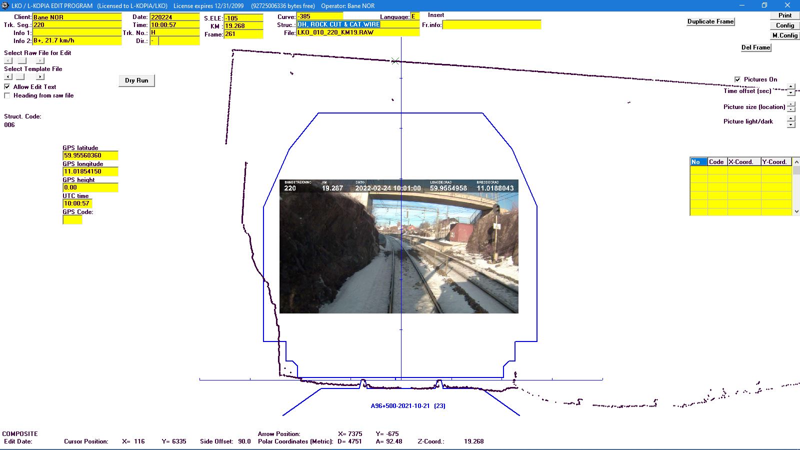
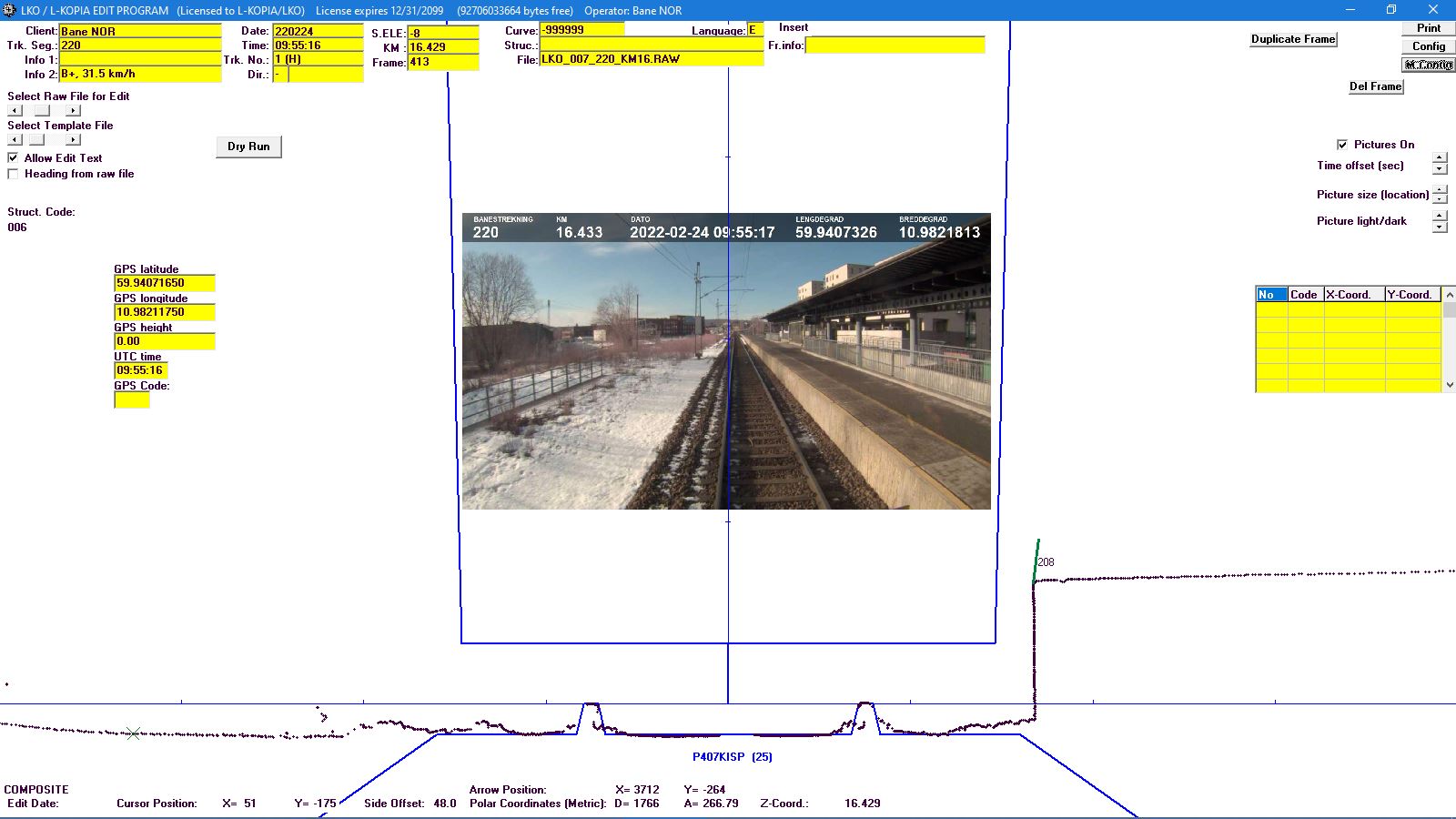
The Z+F LKO/L-KOPIA Clearance Laser System also includes an electronic odometer, an electronic pendulum for cross and longitudinal level, a CCD camera system with superimposed text (continues Mile/Km/Feet readings, Track Segments, Track Numbers, Direction, etc.) from the specialized LKO/L-KOPIA laser software.
LKO/L-KOPIA Clearance Laser Systems (B1, LD, LMS and Z+F) has been in operation since 1993 (first on the market).
The LKO/L-KOPIA Z+F Clearance Laser System produces clearance & surveying data for several applications, such as ClearLoad Simulation, ClearLoad Diagrams, Plots in different scales, AutoCAD conversion, Minimum Track Center and Ballast Calculation and GPS data integration.
Applications for the LKO/L-KOPIA Clearance Laser System:
• Total Clearance Survey (including Track Center Measuring and DVD)
• Collection of continuous Track Center Distances
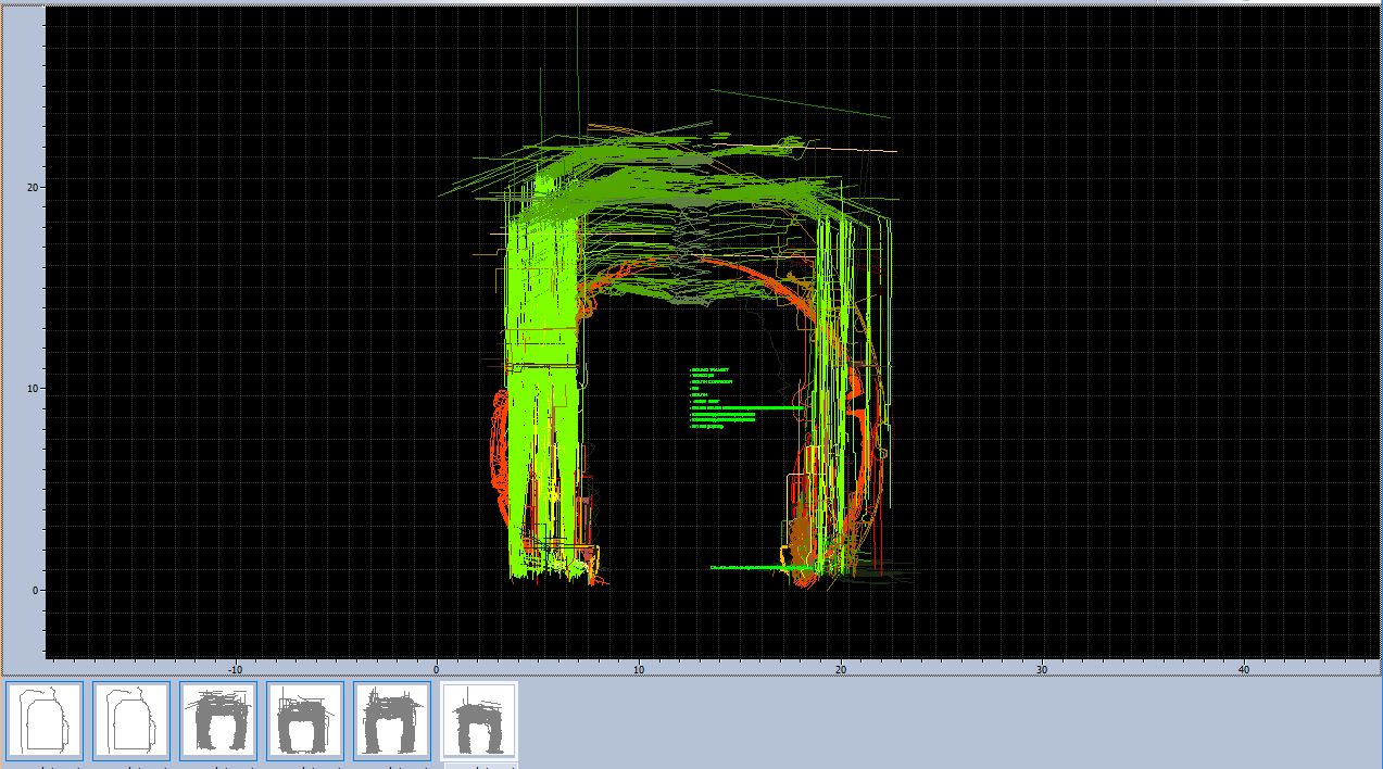
• Cross Sectioning and Area and Volume calculations in Tunnels
• Continues Ballast Volume and Profile Surveys
• DVD taping (separate or together with laser survey)
• Platform “edge” and “gap” surveys
• Load Surveys (checking clearances for oversized loads, real time on track, road or water)
• GPS/DGPS data separate or integrated with our clearance surveys
The Platform Gap option includes calculation from a given Train templates (Platform Safety)!
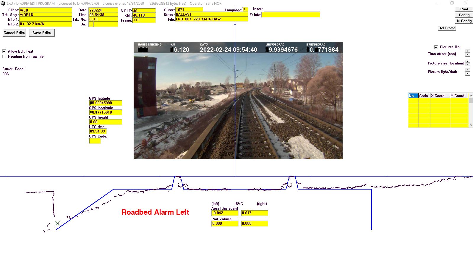
The Ballast Option includes calculation from given Roadbed Templates (both profile and volume).
The LKO/L-KOPIA Ballast/Roadbed diagram shows were to add ballast and total condition (green, yellow or red).
LKO/L-KOPIA has a conversion software from CUS to DXF for use in AutoCAD.
For further information, please contact us via e-mail, phone, fax or mail.